Site Selection
Find the Perfect Spot for Your Business
Platteville has lots of available buildings and lots to choose from. Utilize our tools below, such as Platteville Places Public, Verified Sites, and Traffic Counts, to get help find a location you may be interested in. Alternatively, query our open Industry Park Lots, Commercial Buildings, and Private Lots to find a great place for your business.

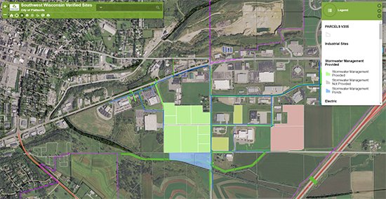
Verified Sites
SWWRPC created an online mapping tool that displays sites available based on acreage, utility services available, aerial and land photos of the site, and all relevant available documentation such as geotechnical, environmental and archaeological reviews. This clearinghouse is equivalent to programs like Gold Shovel and WEDC’s Certified Sites. Simply click on the Verified Sites tab which will take you into this searchable GIS database.
Support for this was made possible from partnerships with Alliant Energy, the City of Platteville, and Delta-3 Engineering.